Sunnier and warmer weather is on the horizon as the UK is set to see another wet and windy day on Tuesday, the Met Office has said.
The beginning of July has seen wet and blustery weather, but conditions are expected to improve this week.
Today we’ll see rain, occasionally heavy across southern parts of the UK, but as the day goes on clouds will start to clear towards the east.
This is due to an area of low pressure close to the UK.
Met Office meteorologist Greg Dewhurst said: ‘Some of these showers could be heavy at times.
‘Odd rumble of thunder is possible, particularly across northern parts of Wales into northern England.’
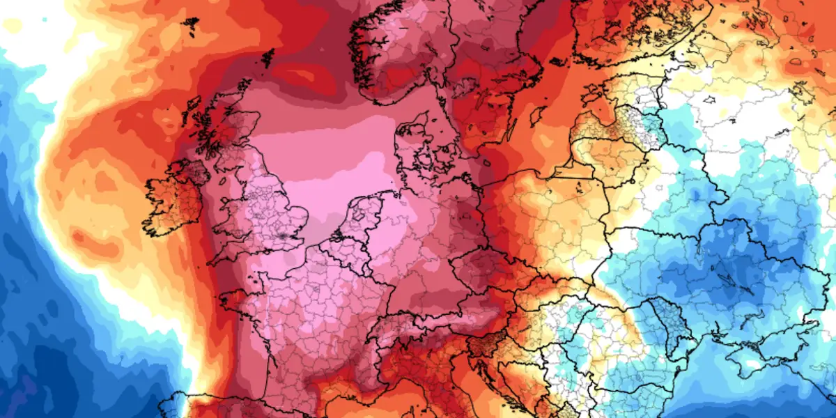
Temperatures are expected to remain around 20°C for the next few days, but this will improve on Friday which is expected to be ‘drier and warmer for many’.
Mr Dewhurst added: ‘By the end of the week into the weekend, [temperatures will be] rising towards 28°C.’
The weather should become more settled by Thursday, with lighter winds expected.
The summer has already got off to a warm start, as the UK experienced its hottest June on record this year thanks to heatwaves in the early part of the month.
The Met Office also said the unusually high temperatures early on in the summer season were driven by ‘the background warming of the Earth’s atmosphere due to human-induced climate crisis’.